Hugo Shortcode list

The list of Hugo Shortcodes on Github is endless... almost endless.

Here are some of the more interesting ones:

Maps with GPX Tracks
* https://github.com/altrdev/hugo-leaflet
* https://github.com/martinschneider/hugo-gpx-shortcode

Archives
* https://github.com/davidsneighbour/hugo-shortcodes

Gallery

  • https://github.com/whimSYZ/hugo-gallery-shortcode
  • https://github.com/Bishma/hugo-shortcodes/tree/main/image-squash
  • https://matze.rocks/images/
  • https://github.com/mfg92/hugo-shortcode-gallery
  • Photos on a Map: https://tmuguet.gitlab.io/hugo-split-gallery/posts/grand-veymont/
  • https://gitlab.com/tmuguet/hugo-split-gallery

Callout:
* https://github.com/mr-islam/hugo-callout

React App and Chart.js
* https://github.com/romankurnovskii/awesome-hugo-shortcodes

Plotly:
https://metalblueberry.github.io/post/howto/2019-11-23_add_plots_with_hugo_shortcodes/

EXIF:
* https://github.com/shombando/shom.dev/commit/7837de9a07fb6bebbd0ba1d4a689cf4cb020a4ad#diff-e09652119eab2b17c2119eefe3e1b9c388520440620609a8d6118cc099930635
* https://github.com/shombando/shom.dev/tree/7837de9a07fb6bebbd0ba1d4a689cf4cb020a4ad
* https://shom.dev/posts/20220128_hugo-photos-with-exif-data/
* https://github.com/Wivik/hugo-shortcodes

Google Contact Form:
* https://github.com/pkgstore-old-01/hugo-ui-shortcodes/blob/main/layouts/shortcodes/form-contact.google.html

Render PDF to the browser:
* https://github.com/sytranvn/hugo-pdf

Analytics:
* https://github.com/holehan/hugo-component-matomo

Podcast feed:
* https://github.com/valeriogalano/podcast-feed-hugo

atom feed:
* https://github.com/jhauraw/hugo-atom-xml-template

Convert to Hugo
* https://github.com/hzmangel/wp2hugo

Sections
* https://cloudcannon.com/blog/the-ultimate-guide-to-hugo-sections/

Types of Linguistic Maps: The Mapping of linguistic Features and Researcher Interactivity

A couple of years ago I had a chance meeting with a cartographer in North Dakota. It was interesting because he asked us (a group of linguists) What is a language or linguistic map? So, I grabbed a few examples and put them into a brief for him. This past January at the LSA meeting in Portland, Oregon, I had several interesting conversations with the folks at the LL-Map Project under Linguists’ List. It occurred to me that such a presentation of various kinds of language maps might be useful to a larger audience. So this will be a bit unpolished but should show a wide selection of language and linguistic based maps, and in the last section I will also talk a bit about interactive maps. Continue reading

Remoteness Index

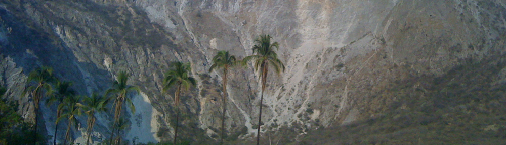
For the last few weeks I have been thinking about how can one measure the impact on a language due to a language communities' contact with other languages. I have been looking for ways that remoteness has been measured in the past. I recently ran across a note on my iPhone from when I was in Mexico dated March 8, 2011.

A metric for measuring the language language shift, contact, and relatedness of indigenous languages of Mexico

  • The formation of aerial features
  • Population density
  • Trade and social networks
  • Political affiliation
  • Geographic factors
  • Roads travel opportunities

I remember writing this note: I was standing in front of a topographical map showing terrain regions. This map also had the language areas of Mexico outlined. It occurred to me (having also recently had a conversation with a local anthropologist on the matter of trade routes and mountain passes) that as a factor in language endangerment that these sorts of factors should be accounted for and if it can be accounted for then it should also be able to be graphed (on a map of course). The major issue being that if one just plots a language area without showing population/speaker density in that area then the viewer of that map will get a warped view of the language situation. Population density also does not solely infer where language attrition will likely not occur. And language contact does not automatically happen on the edges of a language area. That is to say, in a country with mountain passes, there will likely be more language contact in the passes as various groups travel to market than in higher elevated mountain villages. This leads to the issue of language diffusion and the representation of language diffusion. But the issue is not just one of language diffusion, it is also one of population diffusion, and population mobility and accessibility to various areas. So in terms of projecting, assessing and plotting language vitality, considering remoteness should be part of the equation. But remoteness is not just a factor on its own, it is more of an index considering the issues mentioned above but specifically considering the issues of geographical remoteness and considering the issues of social remoteness (or contact, even with other villages and cities in the same language and ethnic communities).

I am not currently aware of any index, much less a project which plots this index to a geographical area. However, I have found some previous work worth mentioning which might be related and relevant.

Modeling Language Diffusion With ArcGIS

There is an interesting paper and project on modeling language diffusion with ArcGIS. It was prepared for Worldmap.org by Christopher Deckert in 2004 and presented at the 24th ESRI users conference. [1]Christopher Deckert. 2004. Modeling Language Diffusion With ArcGIS. Paper published in the proceedings of the 24th Annual Esri International User Conference, August 9–13, 2004.  … Continue reading

Remote Areas of the World

The magazine NewScientist has an article from April 2009 [2]Caroline Williams. 20 April 2009. NewScientist. Where's the remotest place on Earth?. http://www.newscientist.com/article/mg20227041.500-wheres-the-remotest-place-on-earth.html. [Link] [Accessed: 27 … Continue reading about the Remotes places in the world it has several maps and abstractions showing how remote (with reference to travel time) places in the world are. The following maps come from the NewScientist article.

Map showing the access ability from one point to another.

Map showing the access ability from one point to another.

Detail of roads in west Africa

Detail of roads in west Africa

Nowhere three weeks from anywhere

Map showing the remoteness of the Tibetan Plateau

The ASGC Remoteness Structure

Another promising resource I found is the ASGC Remoteness Structure which Australia has developed to show how remote parts of Australia are. There is a series of papers explaining the methods behind the algorithms used and the purpose of the study. One of the outputs was the map below. [3]Commonwealth Department of Health and Aged Care. 2001, Measuring Remoteness: Accessibility/Remoteness Index of Australia (ARIA), Revised Edition, Occasional Papers: New Series No. 14 [PDF] [Link] … Continue reading

Australia Remoteness map

Australia Remoteness Map

The Territoriality of Public Health Governance in Mexico

The last resource I am going to mention here is The Territoriality of Public Health Governance in Mexico. A study which plots the Remoteness of Health Care in Mexico. [4] Alberto Díaz-Cayeros and Justin Levitt. August 30, 2011. The Territoriality of Public Health Governance in Mexico. http://irps.ucsd.edu/assets/001/502971.pdf [PDF] [Accessed: 12 February 2012]

References

References
1 Christopher Deckert. 2004. Modeling Language Diffusion With ArcGIS. Paper published in the proceedings of the 24th Annual Esri International User Conference, August 9–13, 2004. http://proceedings.esri.com/library/userconf/proc04/docs/pap1071.pdf [PDF] [Accessed: 27 February 2011]
2 Caroline Williams. 20 April 2009. NewScientist. Where's the remotest place on Earth?. http://www.newscientist.com/article/mg20227041.500-wheres-the-remotest-place-on-earth.html. [Link] [Accessed: 27 February 2011]
3 Commonwealth Department of Health and Aged Care. 2001, Measuring Remoteness: Accessibility/Remoteness Index of Australia (ARIA), Revised Edition, Occasional Papers: New Series No. 14 [PDF] [Link] [Accessed: 2 February 2012]
4 Alberto Díaz-Cayeros and Justin Levitt. August 30, 2011. The Territoriality of Public Health Governance in Mexico. http://irps.ucsd.edu/assets/001/502971.pdf [PDF] [Accessed: 12 February 2012]

Some current challenges in using GIS Information in the SIL International Corporate Knowledge System

Preface

This paper is motivated by an experience in collecting, analyzing, and then redeploying (sharing while making relevant to other corporate SIL functions) corporate intellectual assets. These assets are relevant to both products SIL products and services and corporate processes. This paper attempts to document some of the current challenges presented to the SIL staff person as well as present some items for consideration in overcoming these challenges.
Continue reading